Project TouCans F2 Map
Data provided by GloTEC
3-D Cesium F2 Maps
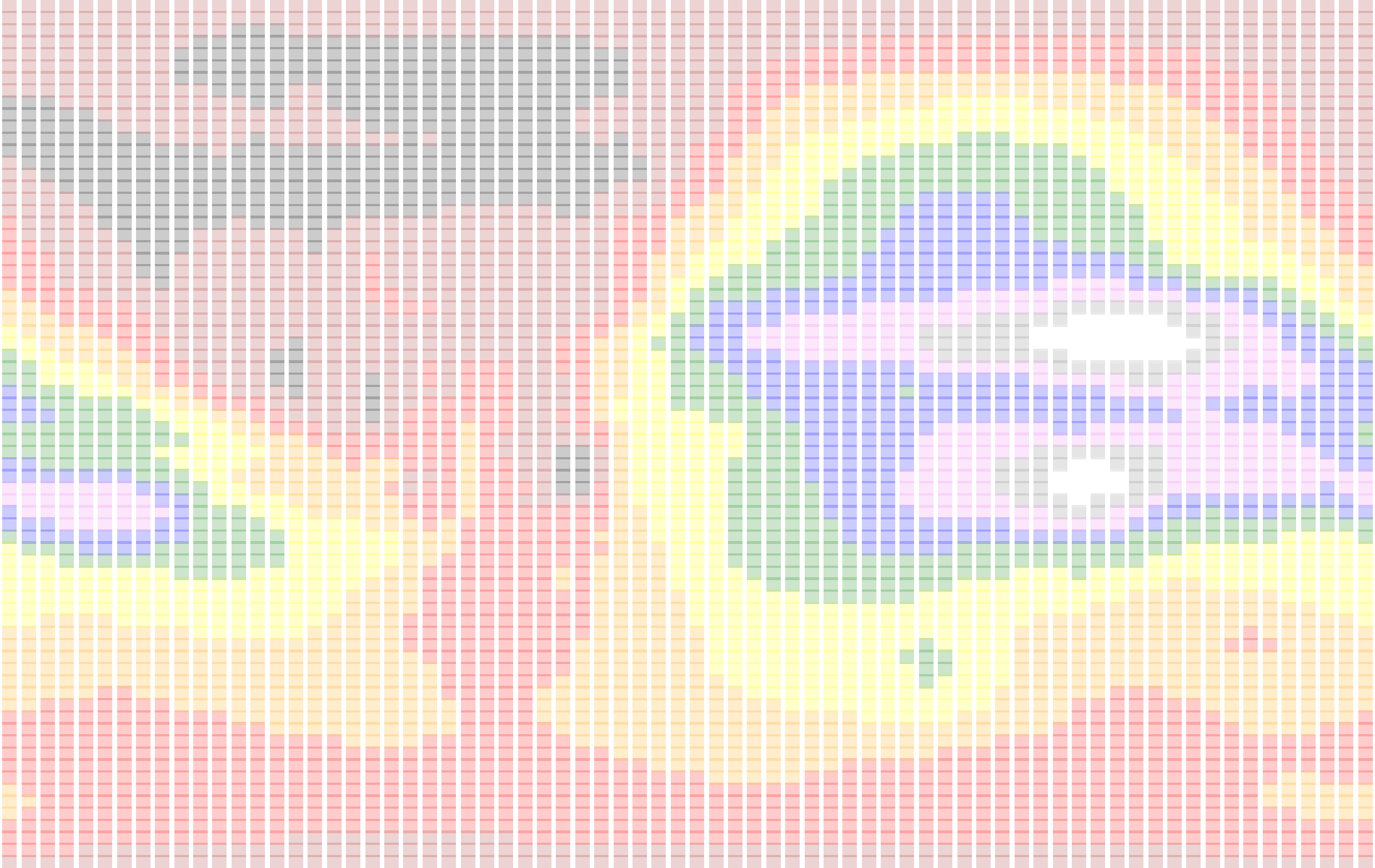
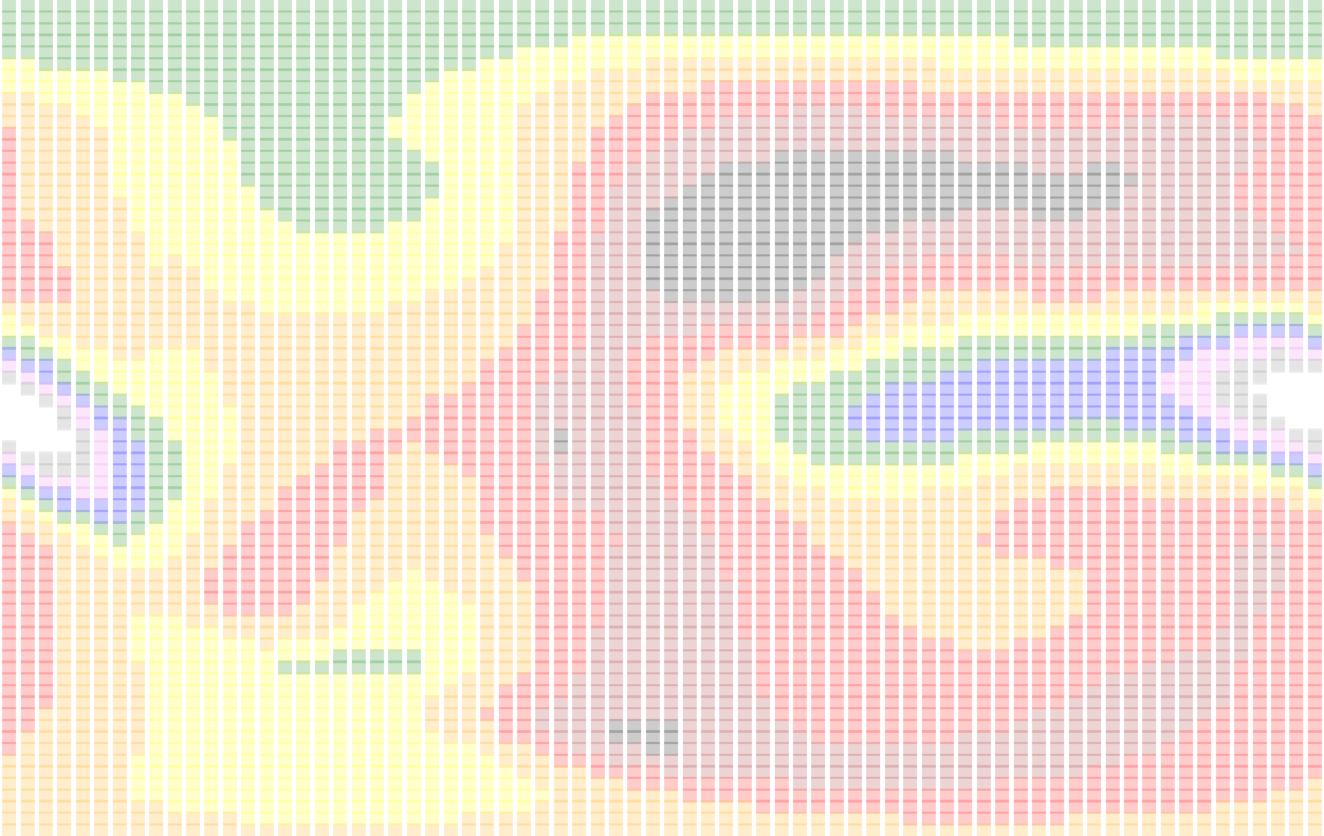
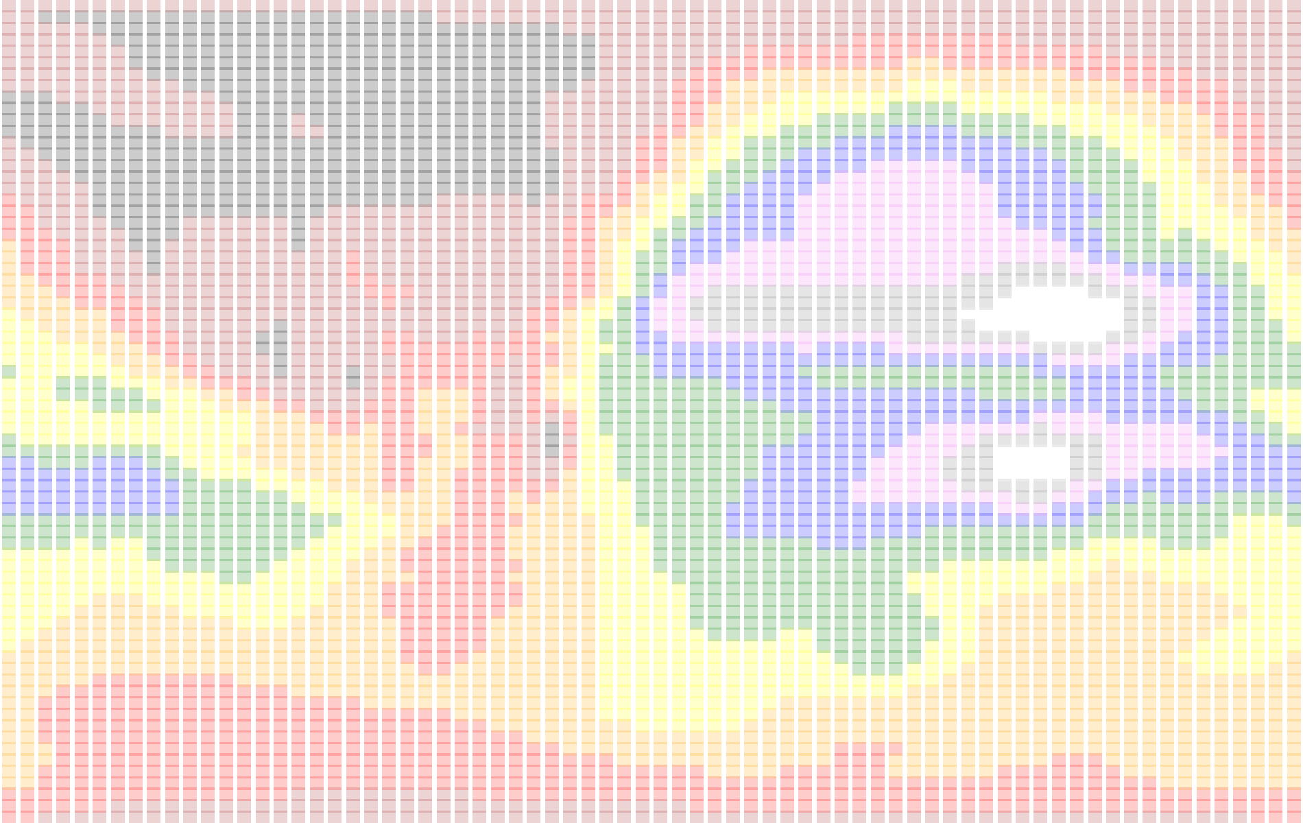
The map below shows the height of the F2 layer from the latest NOAA GloTEC, (Global Total Electron Content), model of the ionososphere. Optimally, GloTEC data is updated by the NOAA every ten minutes with the most recent data being thirty minutes in the past. By hovering over any grid square with your mouse, you'll be presented with the value at that location. The sample time will be shown in the displayed tooltip as well. The maps display foF2, (critical frequency), height of the F2, (hmF2), layer per the model, and the maximum usable frequency, MUFD(3000km). 73 de KD0FNR and KO6BTY.

)</script>)
Hover over a grid square above for the most recent foF2 value
)</script>)
Hover over a grid square above for the most recent hmF2 value
)</script>)
Hover over a grid square above for the most recent MUFD(3000km) value
Comments
Post a Comment
Please leave your comments on this topic: