The KD0FNR Rockmite transmitted it's furthest disnce ever last night. It was spotted by an SDR in Newton, NH, W1NT. The heading to the station, interestingly, lines up with the previous record in Maui. I used the maps API to find out how straight the line was.
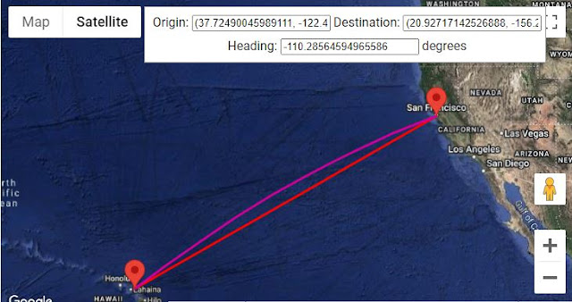
The previous record, (set almost daily), is off to the West in Maui. Here's the two spots on the same map.
For those of who might be wondering if the Boston, NH and the Maui station are on a perfectly straight line, I wondered the same thing. They're not. They miss by about 4 degrees. How do I know? Turns out Google Maps has an API for that. (and a demo).
Using the demo, I was able to get the two headings and then add them to determine how close to a straight line (180 degrees it actually is).
OK, let's look at the headings. To Newton, NH, we have
To Maui we have
Adding the two headings we get 176.0069 degrees. So not quite on the exact same line to the antenna, but close. I also wondered if my imprecision about choosing antenna locations on the map might have mattered. The following gif shows it didn't. Anywhere on Maui only changes the heading by less than a degree.


Comments
Post a Comment
Please leave your comments on this topic: